
Every hour a weather observer or a ASOS weather system sends out an observation with the current state of the sky. Sky condition reports can help determine the weather over the next several days. For example, the cloud types in the area can indicate if a front is approaching and there may be inclimate weather in the next few days.
There are 27 internationally known states of the sky. These sky states are represented by code numbers that represent the types of clouds and the combination of the different cloud layers in the sky.
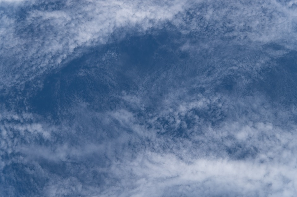
Cloud Identification
There are 27 states of the sky. How much do you know your cloud types? Keep your head in the clouds!

Cloud types are determined mainly by the type of lift that causes the cloud. There are four types of lift that cause cloud formation. Convective lift, Orographic lift, Frontal lift, and Mechanical lift.
Convective lift is the heating of the surface causing a drop in pressure due to hot air rising. This level is indicated on a skew-t sounding.

Orographic lift is when a wind is perpendicular to a mountain range or hills with significant height that cause an air parcel to be lifted to the point of condensation.

Frontal lift is when the leading edge of an air mass forces an air parcel up to the level of condensation for clouds to form.

Mechanic lift is when air at the surface flows from two different directions and collide. This convergence cause an air parcel to lift to the condensation level. An example of this is two thunderstorms near each other pouring rain and causing a downdraft. The downdrafts from the two thunderstorms cause outflow boundaries that collide on the surface causing mechanical lift.

Cloud Form
There are three different general cloud forms. Cumuliform, Stratiform, and Cirriform. The primary factor that determines cloud form is the stability of the air. Unstable air tends to rise on its own. Stable air tend to stay at the same level in the atmosphere and conditionally unstable air will remain at the same level of the atmosphere until an outside force provides an initial lift, then the air parcel will continue to rise on its own.
Cumuliform clouds form due to moist, conditionally unstable air initially forced up by a lifting mechanism and becomes unstable. The moist unstable air rises and gradually cools as it rises, reaches saturation and condenses to form a visible cloud formation. Continued addition of moist air maintains the base of the cloud, but the saturated air within the cloud continues to rise forming the puffy cumuliform buildup.
Stratiform clouds may form where stable air is brought to saturation by either the addition of moisture or by cooling the air. Most stratiform clouds form when a layer of stable air is forced upward by a lifting mechanism. The entire cloud cools as it is lifted, reaches saturation, and forms a cloud layer.
Cloud Identification
Clouds are identified by general terms or very specific terms as cloud form, genus, species or variety. Some clouds are significant enough to be identified by a specific name. However, a weather observer is no required to identify every specific cloud, but only to report the amount of the sky covered by clouds. Very few clouds are significant enough to be reported in the remarks of an observation.
Sky coverage is reported along with an estimate of cloud height. The visible sky from horizon to horizon that an observer can see is broken up into eight parts and each eight of the sky covered with clouds is reported. The sky is reported in four states of coverage.
- FEW is when 1-2 eights of the sky is covered.
- SCATTERED is when 3-4 eights of the sky is covered.
- BROKEN is when 5-7 eights of the sky is covered.
- OVERCAST is when all eight eighths of the sky is covered in clouds and there is no sky able to be seen.
Cloud Etage
| Low Clouds | Mid Clouds | High Clouds |
| 0 – 6,500 ft | 6,500 ft – 20,000 Ft | 20,000 ft – +40,000 ft |
| CU – Cumulus | AC -Altocumulus | CI – Cirrus |
| TCU – Towering Cumulus | AS – Altostratus | CC _ Cirrocumulus |
| CB – Cumulonimbus | NS – Nimbostratus | CS – Cirrostratus |
| ST – Stratus | ACSL – Altocumulus Standing Lenticular | |
| SC – Stratocumulus | ||
| STFRA – Stratus Fractus | ||
| CUFRA – Cumulus Fractus | ||
| Mammatus |
Cloud Types & Abbreviations
Below are cloud charts that lists each cloud in their order of priority and their coding order. This is unimportant for the average citizen that admires clouds, but they come in helpful for observers as a reference when coding the states of the sky.
CL Low Clouds
| Priority | CL Low Clouds Present | Code Figure |
| 1st | At least one CB top is clearly striated or fibrous (cirriform); or, by convention, if lightning, thunder, or hail indicates the presence of CB, but the top isn’t visible due to lower clouds. | 9 |
| 2nd | None of the CB tops are clearly fibrous, striated, or in the form of an anvil. | 3 |
| 3rd | NO CB PRESENT SC formed by the spreading out and flattening of CU; other CU may be present. | 4 |
| 4th | CU and SC, not formed by the spreading out of CU, with bases at different levels. | 8 |
| 5th | CU and/or TCU of moderate or strong vertical extent; other CU or SC may be present, but all bases are at the same level. | 2 |
| 6th | NO CB AND CODE FIGURES 4. 8. AND 2 NOT APPLICABLE. USE THE CODE FIGURE OF THE PREDOMINANT TYPE CLOUD. CU with little vertical extent and seemingly flattened and/or _ ragged CU not of bad weather; or | 1 |
| SC not resulting from the spreading or flattening of CU; or | 5 | |
| ST in a relatively continuous layer and/or ragged shreds; or | 6 | |
| STFRA of bad weather and/or CUFRA of bad weather usually below AS or NS. | 7 |
Coding of CL Low Clouds
Cumulus (CU)
Has vertical development that is noticeable. Looks like white fluffy balls of cotton wool. The flat cloud base, and its elevation will depend upon the humidity. The more humid the air, the lower the cloud base.

Towering Cumulus (TCU)

Cumulonimbus (CB)
The thunderstorm cloud that can grow to over 10 miles high. Mature clouds are identified by the flat anvil-shaped top. This flattening indicates the height of the tropopause.


Stratocumulus (SC)
Predominantly stratiform in the form of relatively low gray and/or whitish layer, sheet or patch showing little vertical development. Stratocumulus elements are often arranged in bands or rolls.

Stratus
Flat featureless clouds that are low to the ground. These clouds vary in color from gray to white. Usually covering the whole sky. Stratus clouds also appear in fragments during periods of rain.

CM Mid Clouds
| Priority | CM Mid Clouds Present | Code Figure |
| 1st | AC PRESENT WITH OR WITHOUT NS OR AS Sky is chaotic; AC generally at several levels. | 9 |
| 2nd | AC with sproutings in the form of turrets or battlements or having the appearance of small cumuliform tufts. | 8 |
| 3rd | AC with AS or NS present. | 7 |
| 4th | AC PRESENT BUT NO AS OR NS AC formed by spreading out and flattening of CU or CB and is the only Cm cloud present. | 6 |
| 5th | Semi-transparent AC in bands, or AC in one or more fairly continuous layers (semi-transparent or opaque), progressively invading the sky. | 5 |
| 6th | Patches (often almond-shaped or lenticular) of generally semi-transparent AC occurring at one or more levels and continuously changing in appearance. | 4 |
| 7th | AC in two or more layers, usually partly opaque; or one opaque layer of AC. AC is not progressively invading the sky. | 7 |
| 8th | AC at one level; not invading the sky; greater part of AC is semi-transparent. | 3 |
| 9th | NO AC PRESENT NS or AS; the greater part of which is sufficiently opaque to hide the sun or moon. | 2 |
| 10th | AS, predominately semi-transparent; the sun or moon may be weakly visible through semi-transparent portions. | 1 |
Coding of CM Mid Clouds
Altocumulus (AC)
Composed of mainly water they appear as white or gray colored roll-like elements, bands or individual puffs. Tend to occur in sheets or patches with wavy, rounded masses or rolls.

Altostratus (AS)
Grayish or bluish color, never white, and the greater part is always translucent enough to reveal the sun (or moon). Objects on the ground do not cast shadows and halos are never seen.

Nimbostratus (NS)
Dark gray cloud that produces steady rain. Results from thickening Altostratus. The cloud base lowers as rain increases eventually reaching the ‘low’ cloud region.

CH High Clouds
| Priority | CH High Clouds Present | Code Figure |
| 1st | CC present alone or is the predominant high cloud present. | 9 |
| 2nd | CS PRESENT WITH OR WITHOUT CI OR CC CS covers the whole sky. | 7 |
| 3rd | CS not invading or covering the whole sky. | 8 |
| 4th | CI and/or CS progressively invading the sky. The continuous veil extends more than 45 degrees above the horizon, but does not cover the whole sky. | 6 |
| 5th | CI and/or CS invading the sky and growing denser; the continuous veil does not extend more than 45 degrees above the horizon. | 5 |
| 6th | CH9 NOT APPLICABLE AND NO CS PRESENT CI in hooks or filaments progressively invading the sky and_growing denser. | 4 |
| 7th | Dense CI often in the form of an anvil being the remains of CB. | 3 |
| 8th | CODE FIGURES 3 THROUGH 9 NOT APPLICABLE. USE CODE FIGURE OF PREDOMINANT TYPE CLOUD. High cloud present is a combination of dense CI, CI with sprouting’s (like turrets or battlements), and of CI in tufts; or | 2 |
| High cloud is CI in the form of filaments, strands, or hooks. | 1 |
Coding of CH High Clouds
Cirrus (CI)
Appears as detached clouds in the form of white, delicate filaments, or white, or mostly white patches or narrow bands. These clouds have a hair-like appearance, or a silky sheen, or both.

Cirrocumulus
Thin, white patch or layer of cloud without shading. Composed of very small elements in the form of grains or ripples. Most elements appear less than the width of one finger.

Cirrostratus (CS)
Transparent or semi transparent, whitish cloud veil with hairlike or smooth appearance, totally or partially covering the sky, and often producing a partial or complete halo.


Types Of Fog & How They Are Formed
There is one main difference to know when referring to fog and that is visibility. In the aviation world, and as weather is reported on a METAR observation, the visibility is reported and does determine the difference between mist and fog. If the visibility is reported at 5/8 miles or less, then the obstruction is reported as fog. If the visibility is greater than 5/8 mile the obstruction is reported as mist. Although, there is no physical difference between the two.
Radiation Fog
Beginning in September morning fog becomes more and more common in the USA. Clear, calm fall nights supply the ingredients needed to form “radiation” fog, which is also known as “ground” fog. It’s called radiation fog because the process begins with the radiation of heat from the Earth into space on clear nights. If there are clouds in the sky, the heat would radiate back to the ground, keeping it warmer. As the ground cools on a clear night, it cools the layer of air near the ground. If the air is humid enough, the water vapor in it begins condensing into tiny water droplets that float in the air – fog. This kind of fog is called ground fog because it hugs the ground, often no more than a couple of hundred feet thick. Wind can prevent formation of fog. Wind blowing over hills, trees, houses and other obstructions becomes turbulent with up and down motion. This pushes cold air upward from the ground and brings down warmer air, keeping the air from becoming cool enough to create fog. Fog often forms in low places because as the air cools it becomes heavier and flows downhill. After dawn, the sun’s heat begins warming the ground and air, evaporating the fog. A common term for this is to say the fog “burns off.”

Advection Fog
South winds often bring warm, moist air into a region, possibly ending a cold outbreak. As the warm, moist air flows over much colder soil or snow, dense fog often forms. Warm, moist air is cooled from below as it flows over a colder surface. If the air is near saturation, moisture will condense out of the cooled air and form fog. With light winds, the fog near the ground can become thick and reduce visibility to zero. The thickest advection fog usually forms during nights with light winds. The reason for this is that humid air near the ground isn’t mixed with drier air above. Usually, the fog burns off during the day, but it can last for many days if it is thick enough to block out the sun’s light. This type of fog is known as “advection” fog. “Advection” refers to horizontal air movements, such as those that bring warm, moist air into a region. Advection fog is very common during winter warm ups and early spring thaws and can occur almost anywhere in the USA. The dense fog can wreak havoc on commuters and travelers and often causes major delays at airports.
Upslope Fog
People who live along the Front Range of the Rockies, where the mountains give way to the Plains, know that the term “upslope” can be bad news. In fact, local forecasters in places such as Colorado Springs and Denver, sometimes refer to “up slop” weather being on the way. They’re talking about what happens when humid air from the east blows across the high Plains and up the slopes of the eastern side of the Rockies. As air rises it expands and cools. If air cools enough, the humidity in it begins condensing into fog, clouds, rain, or snow. Rising air cools at the rate of about 5.5 degrees for each 1,000 feet it rises. Upslope winds sometimes bring widespread fog to the Plains and rain and snow to the hills and mountains on the western Plains and in the eastern Rockies. The same thing happens, of course, in any mountain range and accounts for mountains usually having more snow or rain than nearby lower elevations

Evaporation Fog (Steam Fog)
One of the signs of fall, along with falling leaves, is the steamy look that ponds, lakes and rivers take on when chilly air blows across them. The “steam” is really fog, naturally enough often called “steam fog.” This kind of fog is also known as “sea smoke” when it forms over cold oceans. The process begins when cold, dry air blows over warmer water. Some of the water evaporates into the lower layers of the air and the air is warmed by the warm water. The warmed air rises, where it mixes with colder air above. The mixing cools the air enough to begin condensing some of the newly added water vapor back into tiny droplets – fog. If you look closely, you see that the bottom of the fog is at least a few inches, maybe a couple of feet, above the water. The fog begins forming when the rising air is high enough to be cooled. Steam fog is most common in the fall because the winds begin turning chilly, but the water is slower to cool. Eventually the water cools enough that it no longer evaporates as much moisture into cool air.

The picture above is an example of when Ohio gets a week or so of warmer water and the a cold front comes through and the colder air behind the front (given there is little to no wind) moves over the warmer water.
Valley Fog
The name says it all. Valley fog, which settles into the hollows and basins between hills and mountains, is a type of radiation fog. When cooler, heavier air laden with condensed water droplets is trapped beneath a layer of lighter, warmer air and hemmed in by ridges and peaks, it can’t escape and often lingers for days. Valley fog occurs as cooler air drains downhill into a valley. The increase in temperature with height creates an inversion and caps the moisture below.

Frontal/Precipitation Fog
Frontal fog occurs when warm rain falls through cold air and evaporates until the air becomes saturated. This type of fog is common with a warm front but it can occur with slow moving cold fronts as well. Cold air, dry at the surface while rain is falling through it evaporates and causes the dew point to rise. This saturation forms fog.
Freezing Fog
When water droplets in fog are supercooled below the freezing point, they remain in a liquid state as drizzle and freeze when they come into contact with a surface creating ice crystals. When these droplets hit the freezing surface, the result is white rime. An example of this is when we used metal ice trays and these trays would get the white rime ice on them. Another example is the older refrigerators that did not have self-defrosting freezers. These feathery ice crystals coat everything and magically transform the world into a winter wonderland.
Frozen Fog
Not to be confused with freezing fog, frozen or ice fog forms when water droplets in fog are super-cooled below the liquid-state point to extreme subzero temperatures. There they turn into ice crystals that remain suspended in the air.
This type of fog is seen in arctic or polar regions; temperatures must dip to 14 degrees Fahrenheit or lower. Your best bet for this bone-chilling experience? Head north to Alaska or the Arctic.
