
As an air mass begins to move out of its source region, there are modifications that take place. These modifications change the stability of the air mass and the laws of physics apply when it comes to the atmospheric forces that occur.
It is important to know to determine the modification process. Since air masses start out cold or warm and moist or dry, once the air mass starts to move is when the modification begins. Using this information will help us determine the significance of modification that takes place to the air mass.
There are several atmospheric forces that effect an air mass as it moves from its source region. These forces show up as the air mass is being modified and can determine the severity of the weather associated with the air mass.
Atmospheric Stability


Warm air wants to rise and cold air want to sink due to the different densities. When warm air is over cold air, the atmosphere is stable, since the warm air wants to be up and the cold air wants to be down. When Cold air is above warm air, the atmosphere is unstable since the cod air is trying to sink and the warm air is trying to rise. This causes a mixing and depending on the temperature and moisture content, clouds and precipitation can occur.


There are several parameters that determine the various ways an air mass can be modified. The parameters that are classified as air mass modifiers are as follows:
- Temperature
- Moisture
- Topography
- Trajectory
- Age.
Effects Temperature Has On An Air Mass Stability
The degree of thermodynamic modification is dependent on the temperature differences between the air mass and the underlying surface. The airmass will begin to modify as soon as it begins to move out of the source region.

Cold Air over a Warm Surface
An cold air mass moving over a warmer surface will be warmed from below causing the lower levels to become unstable. This will cause cumuliform clouds to form and showery type precipitation (rain, snow or ice pellets). Because the air is unstable, there is much mixing taking place resulting in good visibility except in showers.

We give this air mass a “k” thermodynamic indicator. For example, a continental polar air mass moves south into the United States will be designated cPk.
Warm Air over a Cold Surface
When an air mass moves over a colder surface, it will be cooled from below. This will cause the lower levels to become more stable. As you have already learned, stable conditions means little vertical motion and stratiform clouds and fog. Precipitation will be sparse with some light drizzle, if any at all. The visibility will be poor in industrial and populated areas due to pollutants being trapped below the resulting temperature inversion that is formed.

We give this air mass a “w” thermodynamic indicator. For example, a maritime tropical air mass moves north into Mississippi in the winter will be designated mTw.
Moisture
Amount and rate of moisture modification is dependent upon the temperature differences between the air mass and the underlying surface.
Addition of Moisture
Moisture is added to an air mass by evaporation. Since three-fourths of the earth is covered by water, this is a significant factor in the modification of air masses. The ocean is the most important source for moisture. Other sources include lakes, rivers, and moist ground (swamps). Ice and snow add a very small amount of moisture through sublimation.
The addition of moisture decreases the stability of the air mass. Moist air is less dense than dry air causing the moist air to rise.
Removal of Moisture
Moisture is taken out of an air mass by condensation and precipitation. This makes the air mass more dense which in turn increases stability.
Rate of Modification
The rate of moisture modification sufficient to change classification depends upon the type of air mass. The transformation from continental to maritime occurs very rapidly, averaging around 2 days. The transformation from maritime to continental occurs very slowly averaging from five to seven days. These periods are general guidelines only, other factors such as topography play a significant role in air-mass modification times.
Effects Topography Has On Air Masses
Any change of topography will result in modification of the air mass.
Mountains
The amount of modification depends on the orientation and altitude of the mountain chain to the oncoming air mass. Air masses that are forced over a mountain range like the Rockies will change. An air mass flowing next to a parallel range will not be affected.We have learned that air forced up the windward side of a mountain range will lose moisture through condensation and precipitation. The air becomes unstable because heat is released. On the leeward side of the mountain, air is warmed and dried by compression. The stability increases due to subsidence.

Lakes
The effects of a modification of the air mass can be observed on the leeside of the lake. Cyclones fall and winter, result in intense vertical mixing and convective clouds. 6,000 feet thick, can result in significant rain or snow showers over the crossing the Great Lakes during Clouds, typically only 5,000 to lakes and adjacent shores. Stratocumulus clouds can persist for several hundred miles downwind.
Oceans
Modification is great when an air mass moves over the ocean because of its great size. When a cP air mass moves over the ocean, moisture and temperature properties are greatly changed. In winter, the land is colder than the ocean; therefore, the air from land (cP) is heated from below. As it moves over the warmer ocean, it is unstable in the lower levels_Rapid evaporation of water from ocean surface rises in convective currents.
During summer, the land is warmer than the ocean, therefore, the cP air mass is cooled from below stabilizing the air in the lower levels. The addition of moisture is usually limited to the lower levels.
When a mT air mass moves northward over the mP source region, the modification is not great because both air masses are moist. However, temperature modification is important. The air mass is cooled from below and it is stable in the lower levels. The longer an air mass is over the ocean the more moisture it takes on.
Land
Modification is great when a maritime air mass moves over land. The air mass dries out. The mP air mass comes onshore over the western North America and Europe and starts to change. It usually takes about five to seven days to change enough to have continental characteristics. It changes more over the western North America because of the higher terrain. mP air moving across the Rockies dries out and can be classified as “highly modified mP”. It cannot be classified as cP until the air mass completely dries out or is replaced by cP.
In Europe, the land is so flat that a mP air mass that moves-across Europe will not change much until it crosses the Ural Mountains in central Russia. This will keep its maritime characteristics.
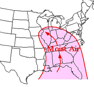
The mT air mass moves inland from the Gulf of Mexico or the Atlantic Ocean. As the air mass inland, it dries out gradually. During the summer months, the mT air mass can move as far north as southern Canada. Dew points can reach into the 60s and low 70s making it very uncomfortable in the Northern Plains, Great Lakes, and New England. Most of the precipitation are thundershowers. In the winter, the mT air mass collides with the cP air mass. The mT air mass provides moisture for mush of the central United States.
Trajectory
The path an air mass follows determines the stability in the upper levels of the air mass.
Cyclonic Trajectory
The flow of an air mass around the subpolar lows decreases stability which enhances weather because of the upward vertical motion. It is given stability indicator of “u”. For example, a cPk air mass flowing off Siberia.will be designated as “cPku” as it moves around then Aleutian low.

Anticyclonic Trajectory
The flow of an air mass around the subtropical high increases stability which dampens weather because of the downward vertical motion. It is given a stability indicator of “s”. For example, a mTw air mass flowing north from the Gulf of Mexico in summer will be designated “mTws”.
Age Also Has An Effect On An Air Masses
The longer the air mass is away from its source region, the more modification possible.

There are several forces that effect air parcels in an air mass. These forces are what cause the wind to blow in the first place and will have some affect on wind speed and direction. They also affect the heights of the air mass in a region and will even affect the rotation of a pressure system which can change the out come of the weather associated with that system.
GRADIENT FORCES
Pressure Gradient Force (PGF)
Pressure Gradient Force (PGF) is a force acting on a parcel of air, resulting from the difference in pressure on either side of the parcel.
This pressure difference is what causes the wind to blow. Wind always blows from high pressure toward low pressure. In the winter when you have the heat on and your house is 70°F an it is 30°F outside, the cold air is heavier than warm air and when you open the door that cold wind always blown into the house. It is the opposite in the summer.

Pressure Gradient (PGF=ΔP/Δn), is the rate of pressure change (ΔP) with distance (Δn). On a weather chart, it is always measured perpendicular to the isobars. Along the “n” axis in the natural coordinate system.
Changes in pressure result from a change in the quantity of mass over a given point. This may be the result of the actual removal/addition of mass or a change in the density of the atmosphere by differential heating/cooling. Pressure gradient force is directly proportional to the strength of the pressure gradient. If the pressure gradient increases, then the pressure gradient force increases. If the pressure gradient decreases then the pressure gradient force will also decrease.
PGF=ΔP/Δn
The negative sign in the equation shows that the pressure gradient force, a vector, is always directed towards lower pressure, perpendicular to the isobars. This force will act to move air parcels towards lower pressures which initiates the wind.
Contour Gradient Force
Contour gradient force (CGF) is the force that represents PGF on a constant pressure chart.

Contour gradient (CG = Δz/ Δn), the rate of height change with change in distance on a constant pressure surface. Much like hills and valleys on the earth’s surface correspond to the higher and lower height values, respectively, on a constant pressure surface. Differences in virtual temperature and the quantity of mass over a given point in the atmosphere results in changes in thickness between layers. These variations in height result in the contour gradient.

Contour gradient force is directly proportional to the strength of the contour gradient. If the contour gradient increases then the contour gradient force must also increase. Conversely, if the contour gradient decreased then the contour gradient will decrease.
CGF=-g Δz/Δn
The negative sign shows that contour gradient force, a vector, is always directed toward lower heights, perpendicular to the contours. This force will act to move air parcels toward lower heights which initiates the wind.
Rotational Forces
Centrifugal Force
Centrifugal force (CeF) is an apparent force that deflects particles, and therefore winds, away from the center of rotation. It’s the apparent force which pushes you to the outside of the turn as your car goes around a curve. As a kid if you have ever put water in a bucket and spun it around in circles, you have used centrifugal force to keep the water in the bucket.

Centrifugal force (CeF) is always directed outward from the center of rotation and is perpendicular to linear velocity. Centrifugal force is needed to describe the balance of forces present as wind flows around highs, lows, ridges, troughs, or anytime the flow is not in a straight line. The strength of centrifugal force is dependent on two factors. First, the greater the velocity of the moving parcel, the greater the centrifugal force for a constant curvature. Secondly, as the radius of curvature decreases with velocity constant, centrifugal force increases.

Coriolis Force (CoF)
Coriolis force (CoF) is an apparent force exerted on moving objects caused by the rotation of the earth and its coordinate system. It is equal to the product of the coriolis parameter (f) and the linear velocity (v).
This one is quite often argued as a fictional force that has no direct effect on an object in the atmosphere. If you have ever shot a rifle more than 1000 yards, you have probably experienced something that effected the round down range.
Formula CoF=fv (Coriolis Force=force x velocity)
Coriolis parameter is equal to 2 Ω sin(θ), where Ω is the earth’s angular velocity, a constant, and sin(θ), is the latitude. Since the sine of 0° latitude = 0 and the sine of 90° = 1, therefore, coriolis force is zero at the equator and increases as you move poleward. Coriolis force is also dependent on velocity. If the coriolis parameter (f) is constant (for a constant latitude) and CoF = fv, then as the velocity increases, coriolis force also increases. The coriolis force measures the effect of the rotation of the Earth and its coordinate system relative to a moving object in the atmosphere.

То an observer on a star in space (considered a fixed location relative to the rotating Earth) an air parcel moves in a straight line when other forces acting upon the parcel are in balance.

To an observer on the GOES satellite which rotates with the Earth’s coordinate system, (latitude/longitude), or to an observer on the Earth, air parcels are “deflected” to the right of motion in the northern hemisphere and to the left of motion in the southern hemisphere.

Coriolis force always acts 90° to the wind direction, when using the natural coordinate system, the coriolis force is in the -n direction in the northern hemisphere, and the +n direction in the southern hemisphere. The closer you get to the poles, the stronger the coriolis force if wind speed remains unchanged. As velocity decreases, coriolis force and centrifugal force decrease because they are dependent upon velocity. The weaker the velocity for a constant curvature the weaker the centrifugal force. If latitude, and therefore coriolis parameter (f), is constant, then as velocity decreases coriolis force must decrease.
Frictional Forces
Frictional forces opposes motion and slows down everything that moves on the earth’s surface. Friction always acts opposite to the direction of motion. With an increase in friction, the wind velocity will decrease. However, friction has no direct effect on pressure gradient or contour gradient forces.

It will cause both coriolis and centrifugal forces to decrease. Winds will tend to back (a counterclockwise change of direction, backing-up on a clock) toward the stronger force.

Recent Posts
Determining Severe Weather Based On Stability Indexes and Upper-Level Winds
There are several weather products used to determine the possibility of severe weather for an area. The most common and misunderstood by many weather enthusiasts is the Skew-T chart and the upper-air...
Tornado Basics, Severe Weather Preparation, & The Enhanced Fujita scale
Earth's weather can produce various kinds of windstorms which include waterspouts, dust devils and tornadoes. Although they have the common features of a column of rotating air, they are actually...
