
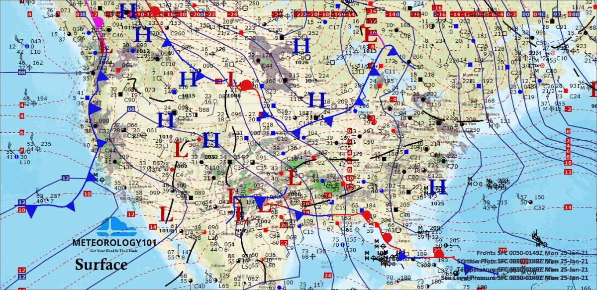
The forecasting of surface anticyclogenesis and cyclogenesis are brought forth and how these effect steering and intensity changes with surface features.
A main point to remember when forecasting a system is to first determine if the system is getting stronger or weaker. below, we discuss several features to look for when making that determination.
Forecasting Cyclogenesis of Baroclinic Lows
Favored Areas of Cyclogenesis
- At and just downstream of long-wave trough axes.
- Negatively tilted troughs with strong difluence aloft.

- Diffluent jet stream pattern (supergradient winds). Major short-wave troughs are likely to intensify when wind speeds upstream are greater than the wind speeds downstream from the trough axis (supergradient condition).
- Under Divergent area ahead of an approaching jet maximum.
Vorticity Indicators of Cyclogenesis
An approaching upper level vorticity maximum with strong divergence interfacing with an existing weak low-level thermal gradient (Petterssen’s Rule).
A definite vorticity advection lobe is associated with each unstable wave on a classic wave train.

Frontal waves tend to develop along slow moving or stationary fronts when a strong vorticity advection lobe is 5 to 7° upstream. If a system occludes, the upper vorticity maximum will stack closer to the surface wave cyclone. If several wave cyclones exist along a front, the wave closest to the strongest upstream divergence will develop at the expense of the others.
Special Cases of Surface Lows
Lee side troughs are associated with subsidence and drying and is not directly visible on satellite imagery. A low amplitude (flat, long-wave) ridge is often present over the mountains. The ridging is consistent with the warm temperatures occurring in the lee of the mountains (due to compression). The low amplitude allows the upper -level winds to have a strong westerly component (high zonal). Strong westerly flow across the mountains is often evident on satellite due to the presence of features such as rotor clouds. An upper-level trough is sometimes located to the west near the U.S. west coast in the case of the Rocky Mountains. A thermal ridge will often appear on the 850mb chart and sometimes as high as 700mb over the lee of a mountain range. Although lee side lows/troughs are generally associated with subsidence and drying, increased moisture or precipitation may occur if moisture is introduced from another source.
The Life Cycle of East Coast Lows
Cyclogenesis along the east coast is common during the cold season. The long-wave pattern normally features a ridge over the central or western U. S. and a trough just inland from the east coast. A frontal system is located offshore, just downstream from the trough axis. This frontal system extends into the Gulf of Mexico. Stable waves develop along the southern reaches of the front in the Gulf of Mexico and propagate northeastward along the front. A weak short-wave trough moves southeastward down the long-wave ridge and intensifies as it approaches the long-wave trough position. As the intensifying short-wave trough approaches the surface front, intense cyclogenesis occurs. The low often intensifies near Cape Hatteras, but a careful analysis reveals it originated much farther south as a stable wave.
The Life Cycle of Alberta Lows (Northwesterly Flow Regimes)
Lows which form in the lee of the Canadian Rockies and move southeast are common during the cold season. The long-wave pattern normally features a ridge over the western U.S. and a trough along the east coast. A rapidly moving short-wave trough causes cyclogenesis along the leeside of the mountains. Strong northwesterly flow causes the low to move rapidly east to southeastward. The surface low is typically weak and precipitation is light since moisture is very limited(Gulf of Mexico moisture is absent from the area). This type of system often intensifies rapidly as it reaches the base of the long-wave trough along the east coast, and the cloud/precipitation shield will grow as the system taps gulf moisture. Many east coast lows originate in this way.
Explosive Cyclogenesis
An explosively deepening baroclinic low is one which deepens in excess of 24mb in a 24 hour period. Such a system has come to be known as a “bomb”. Bombs are important because they produce extremely hazardous weather conditions. Bombs are poorly forecast by the present numerical weather prediction models.
Climatologically, the favored locations for bombs are over the ocean areas, just north of the strongest sea surface temperature gradient associated with the warm Gulf Stream and Kuroshio Currents. They are most common in the Pacific, but more intense in the Atlantic. Bombs are rare over land, but have been observed in the eastern United States on a few occasions. Seasonally, bombs are winter time phenomena. They are most common in the Atlantic in February and most common in the Pacific in December.
Synoptically, bombs normally form at or just downstream from long-wave trough positions, as a short-wave trough approaches the region. They form just north of the band of strongest winds, under diffluent upper-level flow. They are closely related to the development of low zonal flow and blocking patterns. Explosive cyclogenesis in a region is often the first indication of a major long-wave pattern change. Observed structure of bombs has shown strong convection at and near the center of the low. The maximum surface winds, which often approach hurricane force, occur within about 60 nm of the center of the surface low. Most lows which attain very low central pressures (less than 970mb) undergo explosive cyclogenesis. The deep cold barotropic lows (sub-polar lows) often found in the Aleutian and Icelandic regions generally originate as bombs in the favored regions over the Gulf Stream and Kuroshio Currents.
Occasionally jet maxima work together to create a broad area of low level convergence and enhancement of precipitation rates along the East Coast during explosive cyclogenesis. Two jet maxima exist in a region of cyclogenesis, one embedded in the northern branch of the jet, another in the southern branch. When conditions are just right, the developing cyclone will be positioned in the right rear quadrant of the northern jet max, and the left front quadrant of the southern jet max. Therefore, the storm is in the region of PVA or “lift” from each jet max, doubling the effect.

Baroclinic instability and the self-development processes described earlier in this objective are important, but cannot explain the explosive cyclogenesis by themselves. The strong tendency to form over water suggests some other influences are important to the dynamics of development of a bomb. While bombs are not sensitive to sea surface temperature, they normally develop in regions of strong sea surface temperature contrast. Favorable areas are common off the east coast of continents.
As cold polar air moves off the continent and over a warm current, it modifies rapidly from below. Latent and sensible heat are transferred from the water into the air as it warms. This strengthens the baroclinicity in the region. It also decreases the stability and creates a situation where widespread convection can occur near the developing low center. The convection leads to latent heat release which also enhances development.
Forecasting The Dissipation of Baroclinic Lows
Prog dissipation when a low loses upper-level support (short-wave trough outruns the surface feature) or when the low evolves through its entire life cycle and becomes a cold barotropic low (decaying wave).

A cold barotropic low slowly dissipates from the bottom up, with the closed low aloft dissipating last. Boundary layer convergence in conjunction with the diminishing upper-level exhaust adds mass to the column so the surface pressure rises and the low fills. Adiabatic cooling of the rising air causes thickness to decrease so the upper-level low remains, and is situated in the cold pocket.
Forecasting Anticyclogenesis of Baroclinic Highs
Favored Area of Anticyclogenesis
Two favored areas are; at and just downstream from a long-wave ridge axis and where there is confluent flow in the jet stream pattern (subgradient winds). A point to remember is that strong baroclinic highs are associated with convergence aloft and low-level divergence. A complimentary relationship holds true for Petterssen’s Rule in the development of baroclinic highs, however the braking mechanisms are much more effective in developing baroclinic highs.
Baroclinic highs tend to develop behind cold fronts when vorticity minima advection lobes are within 5 to 7° upstream. Baroclinic highs also tend to form on the upstream side of a strong vorticity maxima where strong convergence exists.
Forecasting The Dissipation Of Baroclinic Highs
Prog dissipation of a high when it loses its upper-level support (major short-wave ridge outruns surface high), or the high evolves through its entire life cycle and becomes absorbed into the subtropical ridge.
Highs typically move southeast and the air near the center warms. Modification and stretching of the cP air mass occurs. The front ahead of the advancing high undergoes frontolosys as the air mass modifies and mixes with air ahead of the front. The high becomes absorbed into the subtropical ridge.
Intensity Changes In Synoptic Surface Features
Surface pressure should fall in areas of divergence unless offset by low-level temperature advection. Favored areas for cyclogenesis. Cyclogenesis often occurs at and just down stream of long-wave trough axis, with a negatively tilted trough with strong difluence aloft, with diffluent flow in the jetstream pattern (supergradient), with an approaching jet max (difluence ahead of the jet max), with an approaching upper level vorticity maxima with strong DIV that interfaces with an existing “weak” low-level thickness gradient (Petterssen’s Rule).
Surface pressure should rise in areas of convergence unless offset by low-level temperature advection. Highs most often form at and just downstream from the long-wave ridge axis, behind cold fronts when vorticity minima advection lobes are within 5-7 degrees upstream, or on the upstream side of a strong vorticity maxima where strong convergence exists. Highs build due to increasing convergence aloft which is indicted by upper level height rises increasing.
Isallobaric indicators For Lows (lines of equal pressure change)
Pressure changes reflect past history of systems, and give clues to future changes, but trends cannot always be accurately extrapolated. 3-hour app groups give good indication of short term changes (rapid cyclogenesis, etc.). The 24-hour pressure change chart can be used to eliminate diurnal influences.

If the low is positioned in an isallobaric rise area, the low is filling. If the low is positioned in an isallobaric fall area, the low is deepening.
Isallobaric Indicators For Highs
If the high is positioned in an isallobaric fall area, the high is weakening. If the high is positioned in an isallobaric rise area, the high is building.
Frontogenesis and Frontoloysis
Fronts tend to intensify or frontogenesize when the airmass contrast is increasing (see Atmospheric Dynamics II) due to diabatics. Fronts intensify if they are approaching a deep pressure trough (such as lee-side) or if an area of divergence is over the frontal boundary. Increased cyclonic circulation associated with a deepening low will cause frontogenesis. Fronts also intensify if the angle between thickness line and axis of dilatation of a deformation field is less than 45°.
Frontolysis occurs when airmass contrast is decreasing (see Atmospheric Dynamics II) due to diabatics. Frontolysis occurs when the filling of the low causes decreased cyclonic circulation and when the angle between thickness lines and axis of dilatation of a deformation field is greater than 45°.
Steering Rules For Surface Synoptic Features
Extrapolation and Continuity
Use extrapolation and continuity techniques similar to upper air methods. Trace several 3-hour positions on chart to follow movement of systems. Straight line extrapolation is not too useful beyond 24 hours. Be sure to consider terrain influences. Systems tend to move faster over water and they slow down and become disorganized when passing over mountains, reorganizing on the leeside.
Steering Surface Systems Using Upper-level Flow
This works best when upper-level pattern is not changing or is changing slowly. If the upper level flow is changing, anticipate this and adjust the surface forecast for the new upper-level pattern. Do not steer surface systems using closed flow aloft; find the first level where the flow is open.
Steering Rules for Lows
Surface lows move with the forecasted long-wave pattern and tend to follow a track similar to previous systems until the long-wave pattern changes.
Surface lows move toward the area of strongest warm air advection (evaluate thermal advection on 1000/500mb chart) and will move rapidly if the advection is strong and the upper flow is high zonal (the low will likely reflect as a stable wave).

Stable waves. Stable waves on a frontal boundary move along the edge of a cold air mass. parallel to thickness lines (isotherms), and are usually short-lived. Ensure no upper-level support is expected to develop an unstable wave.

Lows that possess a circular isobaric pattern tend to track toward the center of greatest pressure falls.
Lows possessing elongated isobars will track midway between the trough axis and the pressure fall center.
Unstable waves. Unstable waves tend to move in the direction of the tightest pressure or thickness (thermal) gradient. If the surface isobaric gradient is tighter than the thickness gradient, move the low parallel to the warm sector isobars. If the thickness gradient is the tighter, move parallel to the thickness lines with the tightest gradient. When the two are equal, move halfway between the two.

Unstable waves are steered by the current of the first level aloft where open flow exists (first open flow aloft). Deepening lows tend to deflect approximately 15° to the left of the steering flow, moving toward lower heights, into areas of upper-level divergence. Filling lows will deflect right of the steering flow, toward higher heights, into areas of upper-level convergence.
A low with a warm front extending to the southeast and a cold front to the west or northwest, the surface low moves southeast parallel to the thickness lines along the warm front in the direction of the PFJ.

Lows moving southeast usually intensify and slow down as they begin recurving to the northeast. As the low recurves to the northeast the occlusion process begins and a great deal of energy is used in the process. Therefore, the system slows. This rule works best if a well defined thickness ridge exists on the 1000/500mb chart or a thermal ridge is present on the 850mb chart.
Mature/occluded lows. Mature or occluded lows will move parallel to the isobars ahead of the warm front. The 850mb thermal ridge will usually coincide.

Mature/occluded lows, the axis of which are not vertical (still possess baroclinicity), are steered partly in the direction of the strongest warm air advection and partly in the direction of the strongest winds around the upper low.
Lows tend to intensify and slow while passing over the Great Lakes in fall and winter due to diabatics (heat/moisture source).
Baroclinic lows tend to move at 70% of the 700mb or 50% of the 500mb winds. If either strongly violates continuity, don’t use.
Don’t move a low into a stationary or quasi-stationary high, instead the low usually slows down and moves northward around the high.
Decaying waves. Decaying waves (barotropic lows) with nearly vertical axis move with the upper low, in the direction of the height fall center, parallel to the strongest winds around the low (this may not work in the western U.S. mountains).
Steering Rules for Highs
Polar Outbreak High. Polar outbreak highs usually result from cold barotropic high ridging. Cold barotropic highs are stationary in their source region until an organized jet (usually from the NW) moves over them; then a portion of the cold air mass breaks off and moves southward as a polar outbreak high. Keep in mind that baroclinic highs generally move equatorward (SE) even when the steering flow is westerly. They move toward the strongest cold air advection and maximum pressure rises. Estimate speed by using 70% of 700mb or 50% of 500mb flow in the early development stages. As a developing baroclinic high moves southward, it begins to modify (become a warm high), and movement slows down. They are often absorbed into the subtropical ridge.

Baroclinic highs strengthen and slow down while passing over the Great Lakes in spring and summer. due to diabatic effects (colder surface).
Semi-permanent or Warm Core Highs. These systems move with the seasons. Poleward in the summer and equatorward in winter. Any movement usually associated with movement of the upper-level high. Upper highs move toward height rises or areas of WAA.
Blocking Ridges. A blocking ridge is a well developed upper warm ridge which may show a weak high on the surface. Surface systems do not move through a block, but go north or south or become stationary. Upper-level height rise centers tracking toward the northwest are an indication of a building block.
Steering Rules for Fronts
Fronts will move in the direction of the second standard level winds (if not available use 850mb flow). Cold fronts move at 85% of the second standard level winds in the cold air. Warm fronts tend to move at 70% of the second standard level winds in the cold air ahead of the warm front.
NOTE: The 85% and 70% rules above for cold/warm fronts work best when the flow is strongly perpendicular. The more parallel the flow, the slower the movement.
Use control line extrapolation with fronts. Select control points on the front at different time intervals. Connect points with lines or smoothed curves. Extend lines forward in time to indicate progged positions. You can use constant movement, constant rate of change, or constant percentage change, whichever is most appropriate for that system.

Recent Posts
Determining Severe Weather Based On Stability Indexes and Upper-Level Winds
There are several weather products used to determine the possibility of severe weather for an area. The most common and misunderstood by many weather enthusiasts is the Skew-T chart and the upper-air...
Tornado Basics, Severe Weather Preparation, & The Enhanced Fujita scale
Earth's weather can produce various kinds of windstorms which include waterspouts, dust devils and tornadoes. Although they have the common features of a column of rotating air, they are actually...