
Precipitation is defined as any of the forms of water particles, whether liquid or solid, that fall from the atmosphere and reach the ground.
I was once asked at the weather office “What is causing the snow?” When I started my answer with “high pressure on the surface”, all hell broke loose between my fellow forecasters and they couldn’t believe what I was saying. I guess they were looking for the simple answer to the real question they were asking; why is there precipitation?
The synoptic situation was an upper level low over the region and a high pressure system on the surface. When asked why it was snowing, I immediately thought of the high pressure system causing such a low freezing level and the precipitation falling from the upper level low having to fall through the cold core high; the end result would be snow.
The cause of the precip was the low pressure and the reason it was snow was the high pressure. I guess some people weren’t ready for the unabridged answer. As for me, it was those minor details that produced an accurate forecast.
This system was unusual over North Carolina and when the pilots came in for their weather briefs, they would ask how much snow we should expect and when I gave the answer of five inches on base they were shocked. There was no snow removal equipment in Eastern North Carolina and five inches of snow would shut them down.
Well, it turned out that the GFS models were correct in the early stages of the developing system and the initial predictions on the amounts of precip were accurate. We got the five inches of snow and the base was down for three days.
Forecasting Precipitation Type
The type of precipitation is largely dependent on the height of the freezing level(s) and the depth of the warm layer aloft. Freezing levels can be determined on a skew-t, radar base reflectivity, pilot reports and other methods.
Single Freezing Level
If the freezing level closest to the surface is >1,200ft AGL, forecast liquid precipitation. If the freezing level closest to the surface <600ft AGL, forecast solid precipitation. If the freezing level closest to the surface is between 600ft and 1200ft AGL, forecast mixed precipitation.


Multiple Freezing Levels
Sometimes there are two cold layers with a warm, melting layer in between. If the warm layer is 1,200ft thick, forecast freezing rain (cold rain process) or freezing drizzle (warm rain process). If the warm layer is between 600-1,200ft thick, forecast ice pellets (cold rain process). If the cold layer closest to the surface is < 1,500ft, forecast freezing rain if not, forecast ice pellets.

Melting (Warm) Layer Maximum Temperature
Whether complete melting occurs in a warm layer or not depends on many variables (i.e., depth of warm layer, crystal size, and temperature within the warm layer among others). Most snowflakes melt completely with maximum temperatures in the warm layer between 1°C and 4°C. If the maximum temperature in the warm layer is between these specified temperatures forecast freezing rain, if not forecast ice pellets or snow.
Formation Process
When discussing these processes, warm layer means a layer with a temperature of greater than 0°C, and a cold layer means a layer with a temperature of less than or equal to 0°C.
Warm Rain Process
It is considered a warm rain process when the entire cloud and precipitation are above 0°C.
Clouds and precipitation form in the liquid state. Supercooled water (water droplets at temperatures lower than 0°C) can, at times, be part of a warm rain process. Types of precipitation which forms by a warm rain process are warm rain, drizzle, freezing drizzle.
Cold Rain Process
The cold rain process occurs when the cloud and precipitation occur
partially at temperatures below 0°C.
Clouds and precipitation form at temperatures less than or equal to 0°C in the presence of ice crystals. Types of precipitation which form by a cold rain process are cold rain, snow, ice pellets, freezing rain, and hail.
Liquid Precipitation
Rain/Rainshowers
The difference between rain and rainshowers is that rain is continuous and rainshowers are on and off.

The factor that makes the liquid precipitation rain is the size of the droplet. A water droplet that is 0.02 inch (0.5mm) or larger. If the water droplet freezes on impact, it is called Freezing Rain.
Warm Rain. As cloud droplets grow large enough to fall by collision and coalescence and are below the freezing level the whole time. This occurs in stratus clouds. Cumuliform clouds in tropics.

Cold Rain. Ice crystals that have formed above the freezing level have began to fall through a warm layer that is thick enough to cause the ice crystal to completely melt before hitting the ground. This occurs in stratus clouds. You may have been caught in the rain a time or two and noticed that the rain felt very cold. It is likely this process was taking place above you.

Drizzle
Water droplets that appear to be floating and following air currents or have a slow rate of fall. Droplet size is less than 0.02 inch (0.5mm). If the water droplets freeze upon any surface, they are called Freezing Drizzle.

This is a warm rain process. Clouds grow too small, precipitable drops. This occurs in stratiform clouds.
Freezing Precipitation Types
Freezing Rain
Freezing rain is rain that falls in liquid form but freezes upon impact to form a coating of glaze upon the ground and on exposed objects. It is necessary that the liquid be supercooled before striking the ground. Freezing rain, when encountered by aircraft in flight can cause dangerous accumulations of clear icing.

This is a cold rain process. Snow forms at temperatures less than or equal to 0°C, then falls into a warm layer (above freezing) and completely melts. Then it falls through another cold (freezing) layer and supercools then freezes on contact with the surface. The temperature of the surface must be 0°C or less. (Note: The ambient air temperature may be above freezing, but the surface, which the raindrops hit, must be 0°C). This occurs in stratiform clouds.

Freezing Drizzle
Freezing drizzle is drizzle that falls in liquid form but, freezes upon impact to form a coating of glaze upon the ground and exposed objects. It is also necessary that the liquid drops be supercooled before striking the ground. Freezing drizzle, when encountered by aircraft in flight can cause moderate accumulation of clear icing.
Droplets less than 0.02 inch (0.5mm).

Formation in a Warm Layer. This is a warm rain process. Liquid drizzle drops form, fall through a cold layer and supercool. They freeze on contact with the surface. (Surface temperature must be 0°C or less.). This occurs in stratiform clouds.

Formation in a Cold Layer. This is also a warm rain process, because the drizzle drops form in the liquid state as supercooled droplets (at temperatures below 0°C), fall and freeze on contact with the surface. The surface temperature must be 0° or less. Generally, clouds with cloud top temperatures between 0 and -4°C will contain only supercooled water droplets. With cloud top temperatures of -10°C there is a 50% chance of detecting ice in the cloud.

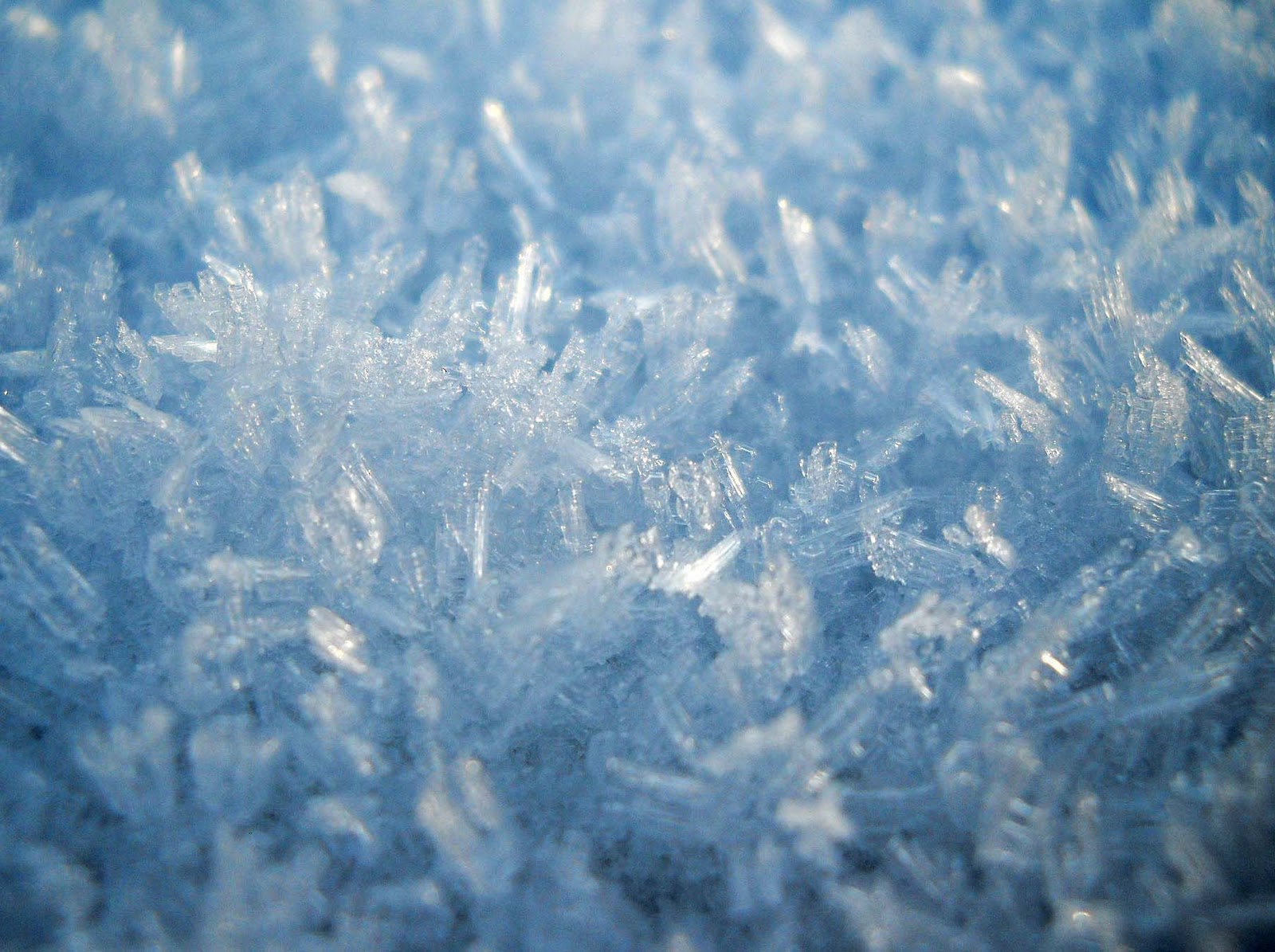
Snow/Snowshowers
White, translucent ice crystals. Highly complex in their true form. Snow flakes fall as individual crystals Fragments of crystals, or clusters of crystals.

This is a cold rain process. Ice crystals grow large enough to fall by deposition and/or collision and coalescence of cloud droplets and other ice crystals. A layer of warm air (greater than or equal to 0°C) may exist above the ground, but it would not be thick enough to melt the ice crystals. This occurs in stratiform (snow) and cumuliform (snowshowers) clouds.

Ice Pellets (Sleet)
Transparent particles of ice that are round or irregularly shaped. 0.2 inch in diameter or less. Bounce or make a sound upon impact. Commonly called Sleet.
This precipitation falls in the solid form. Ice pellets must have a deep cold pocket near the surface and a warm pocket aloft between 600-1,200 ft thick. As partially melted snow falls into the cold air, it will totally refreeze into
ice pellets. This usually occurs in narrow zones between areas of freezing precipitation and snow.

This is a cold rain process. Snow forms at temperatures less than or equal to 0°C. The snow falls into a warm layer (above freezing) and partially melts. Then it falls through another cold layer where it refreezes before hitting the surface. This occurs in cumuliform or stratiform clouds.


Hail
A clear or opaque ball of hard ice. Diameter 1/8 inch to 5 inches or larger. Display a layered appearance. Produced only in thunderstorms.

Cold rain process. Hail forms as snow in the top of the cloud, and grows by collision and coalescence of cloud droplets and other ice crystals. There is a long residence time in the cloud due to strong updrafts. The hail falls from the cloud when its weight is greater than the updraft force. Hail continues to collect raindrops in the lower parts of the cloud where temperatures are above freezing.

Snow Pellets
White, opaque, round kernels of snowlike consistency. 0.08 – 0.2 inch in diameter. Crisp & compressible. May burst upon impact of a hard surface.

Snow Grains
Very small, white, opaque grains of ice. Crystal structure similar to snow, only thicker. Snow Grains do not bounce or shatter on impact.

Ice Crystals
Tiny unbranched crystals of ice. Sometimes called ice prisms. Occurs only in very cold temperatures below -40⁰F. Water vapor may freeze to form Ice Crystals and fall as precipitation without ever forming a cloud.
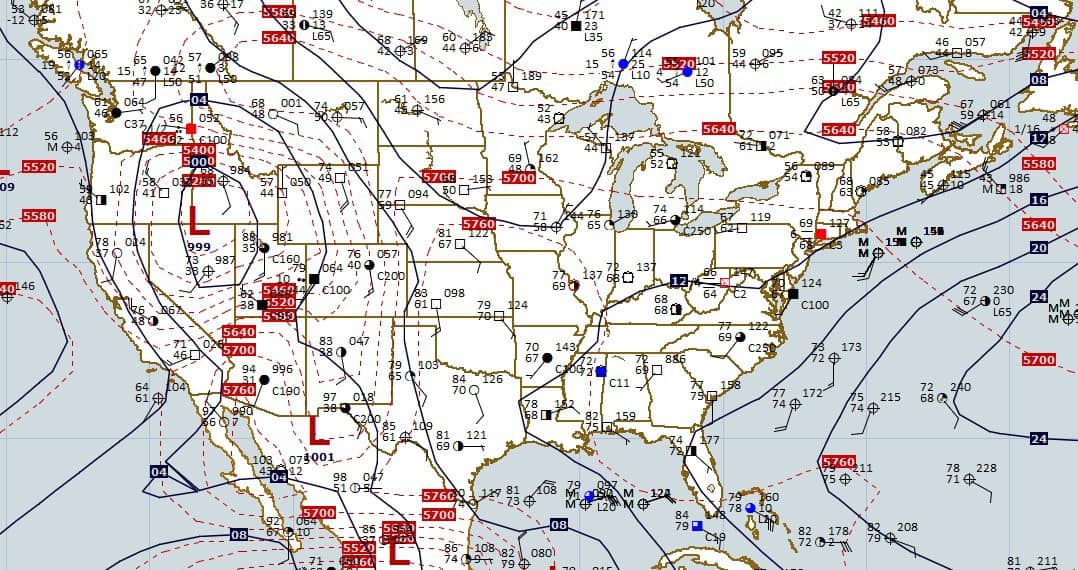
General Forecast Indicators For Precipitation Types
Freezing level(s)
Use the freezing level(s) to determine how thick warm and cold layers are. The height of the freezing level indicates whether ice crystals or droplets can melt or freeze in those layers.

Thickness
Used to predict snow vs. rain. (Example: 540-dam line). Snow is more likely to fall in cold layers and rain in warm layers. Thickness of various layers are examined (e.g., 850-700 mb, 1000-500 mb, 1000-700 mb).


Recent Posts
Determining Severe Weather Based On Stability Indexes and Upper-Level Winds
There are several weather products used to determine the possibility of severe weather for an area. The most common and misunderstood by many weather enthusiasts is the Skew-T chart and the upper-air...
Tornado Basics, Severe Weather Preparation, & The Enhanced Fujita scale
Earth's weather can produce various kinds of windstorms which include waterspouts, dust devils and tornadoes. Although they have the common features of a column of rotating air, they are actually...