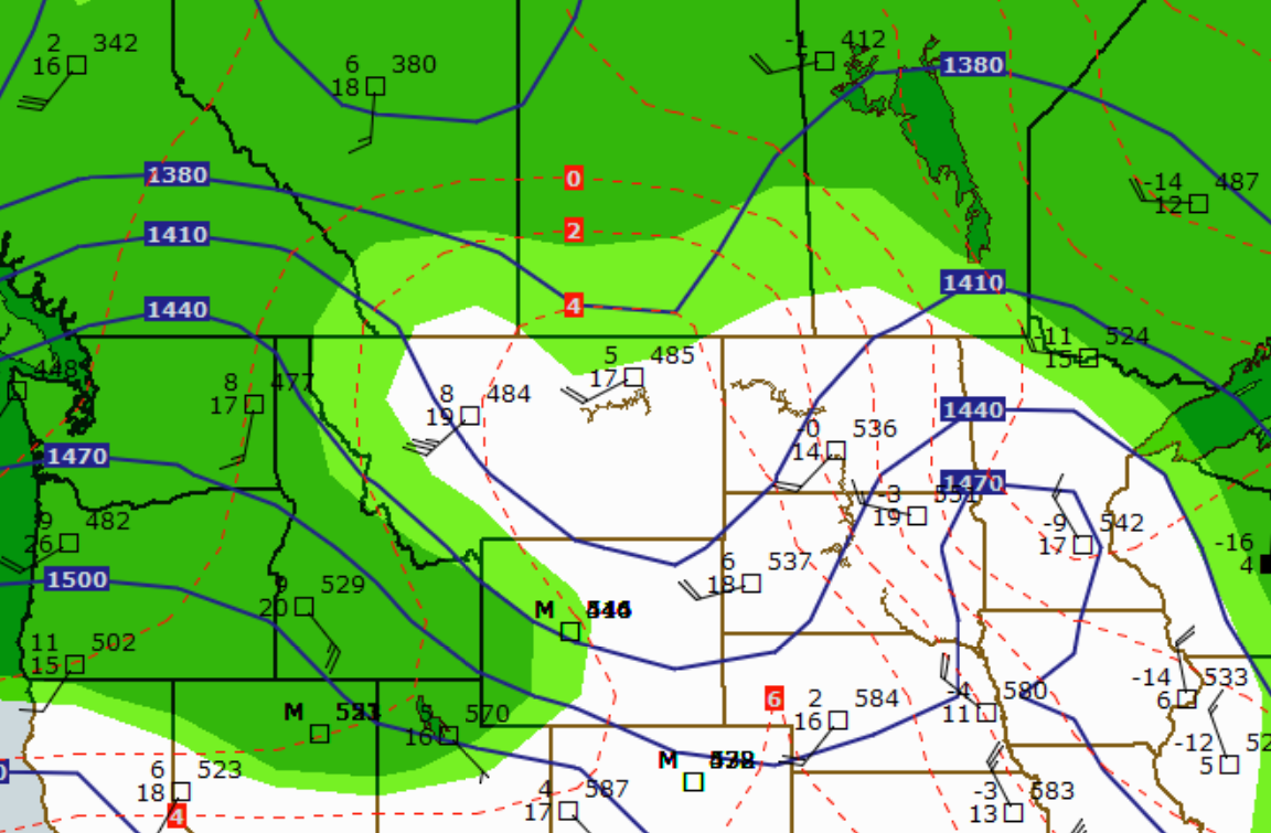
Development of Major Shortwaves
A major shortwave is a disturbance in the mid or upper-levels of the atmosphere which sometimes provides the upper-level support of a surface low. This major shortwave trough induces upward motion ahead of it. If moisture and instability conditions are favorable, the upward motion can contribute to thunderstorm development ahead of a shortwave.
Thermal Advection
The north-south temperature gradient builds when the long-wave pattern is high zonal. This represents an increase in available potential energy for development of short-wave features. This potential energy is transferred to kinetic energy as the short-waves amplify by the process of baroclinic instability.
Major short-wave troughs that result from baroclinic instability are associated with thermal (cold) advection. They produce divergence aloft stacking to the surface as baroclinic lows.
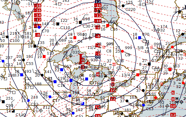
Major short-wave ridges that result from baroclinic instability are associated with thermal (warm) advection, producing convergence aloft, stacking to the surface highs.
Progging Intensity Changes In Major Shortwaves
Effects of Thermal Advection With Difluence and Confluence
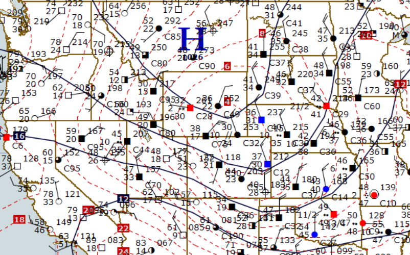
Cold Air Advection (CAA) and difluence in the upper troposphere result in the lowering of upper level heights and deepening of major short-wave troughs, although the primary mechanism causing the increase in the amplitude of the short-wave trough is CAA within the column.
Major short-wave troughs intensify under diffluent upper-level flow. Diffluent upper-level flow may occur in negatively tilted troughs.
Warm Air Advection (WAA) and confluence in the upper troposphere result in increasing upper-level heights and building of major short-wave ridges, although the primary mechanism causing the increase in the amplitude of the short-wave ridge is WAA within the column. Often height rise centers caused by WAA are observed moving northwest when major short-wave ridges build. Thermal advection is usually the best tool for progging increased amplitude of major short-wave ridges.
The effects of deepening major short-wave troughs on downstream major short-wave ridges and the effects of building major short-wave ridges on downstream major short-wave troughs may be similar to the effect on the long-wave pattern.
Major short-wave troughs associated with southward moving vorticity maxima tend to deepen. Evaluate the location of the major short-wave trough in relation to the long-wave pattern. The major short-wave trough should be moving into long-wave trough for this rule to work. A filling major short-wave trough is indicated by stronger Negative Vorticity Advection (NVA) behind the trough than Positive Vorticity Advection (PVA) ahead of the trough. Major short-wave troughs deepen as they move into the long-wave trough, and fill as they approach the long-wave ridge. Pay close attention to the position of the short wave in relation to the long wave. Major short-wave troughs deepen while in the long-wave trough, particularly between trough axis and downstream inflection point. Conversely, short-wave ridges build while moving through the long-wave ridge, particularly between ridge axis and downstream inflection point.
Large amplitude waves generally move slower than small amplitude minor short waves which may progress at nearly the speed of the 700mb winds. Large amplitude waves are using energy for deepening and building; where as, minor short waves use the energy for movement.
Steering of Major Shortwave Features
Extrapolation and Continuity
Extrapolation and continuity are used to establish the history of system (continuity) and project into the future (extrapolation). It works relatively well for periods of 12 or 24 hours, rapidly loses accuracy beyond 24 hours. The basic assumption is that changes in weather will be slow and gradual. The major disadvantage is past and present trends do not continue indefinitely, and new developments will be missed.
Constant Movement Method
A systems future movement will be same as its past movement. For example, if a low moved at 20 knots the previous 12 hours, forecast it to move at 20 knots for the next 12 hours. This is the simplest method to use and requires only one time period to establish continuity.
Constant Rate of Change
This method requires continuity of at least two time periods. Forecast to increase or decrease speed at a fixed rate. For example, if a low moved at 15 knots for first 12 hours and 20 knots for second 12 hours, then forecast movement of 25 knots for following 12 hours (constant rate of acceleration).
Constant Percentage Change
This method is similar to constant rate of change, but assumes the system will change speed at a fixed percentage rather than a fixed rate. For example, if a low moved at 20 knots first 12 hour period and 30 knots second 12 hour period (50% acceleration), would forecast a speed of 45 knots for the next 12 hours.
Control Line Extrapolation
Speed of movement varies for each section of a system. This procedure is useful for forecasting movement of fronts or troughs.
Progging Intensity Changes In Upper Level Lows & Highs
Intensity Changes in High Height Centers
Highs undergo little or no change in intensity when isotherms are concentric to contours. They strengthen when warm air is advected into the west side of the system, weaken when cold air is advected into the west side of the system.
Divergence/convergence associated with jet maxima cause intensity changes to upper high height centers. Evaluate the position of the jet maximum’s divergent/convergent quadrants with respect to the position of the high. The convergent quadrant builds the high and the divergent quadrant weakens it.
Blocking highs strengthen when moving westward and weaken when moving eastward. Ensure strong WAA is occurring between the inflection point and the axis of the major long-wave ridge.
Intensity Changes in Low Height Centers
Lows deepen when cold air is advected into the west side of system and fi ll when warm air is advected into the west side of the system. Often a low height center anchors the long-wave pattern (anchor low), and if moving into a long-wave trough, the low tends to deepen.
Divergence/convergence associated with jet maxima cause intensity changes to upper low height centers. Evaluate the position of the jet maximum’s divergent/convergent quadrants with respect to the position of the low. The divergent quadrant of a jet max deepens an upper-level low and the convergent quadrant fills the low.
A low height center may anchor the long-wave pattern. If this low moves southward into the long-wave trough, the low tends to deepen.
Adiabatic cooling associated with upward vertical motion deepens upper-level lows.
Latent heat release associated with condensation fills upper-level lows.
Steering Rule For Upper-Level Height Centers
Steering Rules for Upper-level Highs
Upper-level highs and/or vorticity minima move with the strongest winds around the high (remaining right of the jet). Upper highs follow slightly to the right of track of associated height rise center. Most height changes relate to short wave movement. Unusually large geographic areas of height change may indicate change in the long wave pattern. If present, evaluate why changes are occurring and prog necessary long wave changes. This will affect steering and intensity changes of upper systems. For speed, use extrapolation.
Steering Rules for Upper-level Lows
Upper-level lows and/or vorticity maxima move parallel to the direction of the max winds around the low, but remain to the left of the jet (this rule works best if the strongest winds are either north or south of the low). Ensure that a cut-off low is not developing.
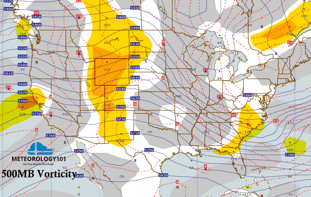
A cut-off low will not usually move out of the southwest U.S. until a strong short-wave trough approaches the Pacific Northwest. This short-wave trough acts as a “kicker”. Ensure the “kicker” is of comparable wavelength. If the low begins to move, it will move in the direction of the strongest wind around the low. The models have difficulty forecasting the development and movement of cut-off lows.
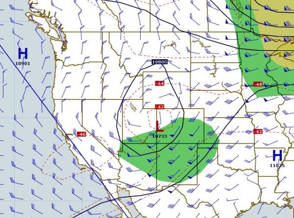
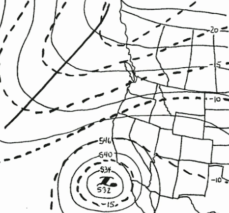
Upper-level closed low height centers follow slightly to the left of the track of the associated height fall center. Evaluate why the height fall changes are occurring. Most height changes are related to short-wave movement, but an unusually large geographic area of height changes may indicate a change in the long-wave pattern. If large scale height falls are present, evaluate why the height changes are occurring and then prog the long-wave changes based on those changes. Keep in mind, this effects the steering and intensity changes of the major short-waves.
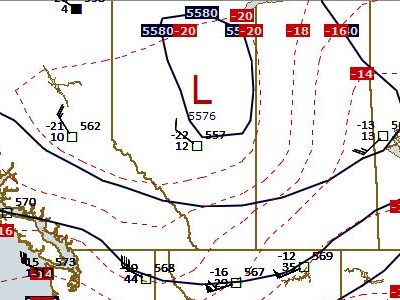
Progging Isotherms In Major Shortwave Features
Maintain similar contour-isotherm relationships from analysis to prognosis. The amplitude of thermal troughs and ridges changes slowly. Isotherms move at about the same rate as major short waves (i.e. keep same wave-phase relationship). Adjust phase relationship to show CAA and WAA on the prog.
Patterns Not To Advect
Heat lows/leeside troughs. Keep in mind that intense heat lows often reflect to 700mb as ridges due to warm air aloft. Do not advect these thermal patterns. They will dissipate as airmass changes occur.
Plateau Highs. Plateau highs are reflected as warm barotropic highs aloft. They tend to remain until the long-wave pattern changes.
Cold Pockets. Cold pockets may rotate around low centers at all levels. When and if the cold pocket becomes coincident with the low center, it tends to remain there.
Progging Moisture In Major Shortwave Features
Areas with dew-point depressions of 2° C or less are considered significant for progging the development of clouds and precipitation. Before progging analyzed moisture areas, compare them with observed clouds (from satellite pictures or HWD). If no clouds exist in areas of analyzed upper air moisture, the significance and accuracy of station(s) must be questioned. Moisture areas advect with major short-waves.
Moisture areas should be forecast based on source regions. Moisture from a cold cP source region has already condensed and will probably not produce much precipitation. A mT airmass (Gulf of Mexico) would have abundant amounts of moisture (warm air holds more moisture) and could produce a great deal more precipitation.
Progging the Increase or Decrease of Moisture
If divergence is increasing out ahead of a deepening major short-wave trough, forecast the moisture to increase at that level. If divergence is decreasing ahead of a filling major short-wave trough, forecast the moisture to decrease at that level. An Increase or decrease of moisture could be due to movement over oceans, lakes, or land surfaces.
Orographic Barriers, Leeside And Windward Side Effects
Ensure onshore flow is occurring and the terrain is at or just below the elevation of your chart. Mild orographic effects may cause stratiform conditions up to 850mb. Be familiar with typical synoptic moisture patterns.
Recent Posts
Determining Severe Weather Based On Stability Indexes and Upper-Level Winds
There are several weather products used to determine the possibility of severe weather for an area. The most common and misunderstood by many weather enthusiasts is the Skew-T chart and the upper-air...
Tornado Basics, Severe Weather Preparation, & The Enhanced Fujita scale
Earth's weather can produce various kinds of windstorms which include waterspouts, dust devils and tornadoes. Although they have the common features of a column of rotating air, they are actually...

